
What to Expect When You Commission Drone Surveying Services: A First-Time User’s Guide
 If you’re planning on commissioning drone surveying services for the first time, it can be hard to know what to expect. At Xizmo Media, we work with clients from many different industries—some with years of experience, others who are just starting to explore what drones can do. We’ll walk you through the process step by step, so you know exactly what happens when you hire a professional drone team for surveying.
Step 1: Inquiry and Scope
The first step is reaching out. When you contact Xizmo Media, we’ll ask about your project so we can understand the scope. Every drone survey is different, and we want to deliver the data you actually need.
We’ll ask for a few key details:
- The size of the property or structure
- The type of area (flat land, hills, city blocks, water, etc.)
- What kind of output you’re looking for (images, video, 3D models, maps)
- Your timeline and any key deadlines
You don’t need to know the technical terms—that’s our job. Just tell us what you want to understand, monitor, or document. From there, we’ll recommend the right type of survey and equipment.
Step 2: Flight Planning
Once we know the scope, our team begins planning the mission. We’ll design flight paths that capture the most useful data, based on your goals. This could include flying over a construction site, scanning a farm field, or mapping a property line.
If your drone survey is in or near a major city like New York, we also check for airspace rules. We’re experienced in navigating FAA regulations, local restrictions, and any permit needs. We’ll also confirm access points, especially if the survey involves tall buildings, bridges, or rooftops.
You’ll receive a clear plan for what the day will look like, including estimated time on site and what will be captured.
Step 3: Survey Day
On the scheduled day, our licensed drone operator arrives on site and walks through the setup. We always follow safety checks before takeoff and keep communication open with any site managers or crews nearby.
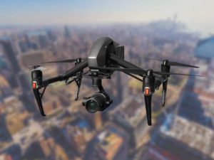
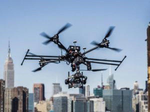
During the flight, our equipment captures high-resolution visuals or sensor data, depending on the project. This can include standard aerial photography, thermal imaging, or LiDAR scans.
Because drones are fast and flexible, most surveys take far less time than manual inspections or ground-based work. In many cases, we can cover a large area in a single visit. Our team follows strict protocols to gather reliable and repeatable data.
Step 4: Post-Flight Deliverables
After the flight, we begin processing the material. This step depends on what kind of data was captured and how you need to use it.
Deliverables may include:
- Still photos or high-definition video
- 3D terrain models
- Orthomosaic maps
- Site progression reports
- Visual inspection footage
- Custom file formats for GIS or CAD tools
We offer fast turnaround and keep communication open throughout the editing process. If you need the files in a specific format or layout, let us know—we’ll make it happen. Whether you’re a contractor, engineer, planner, or landowner, we aim to make the data easy to understand and use.
A Note About NYC Projects
 If you need professional drone services in New York City, you’re working in one of the most complex environments in the country. Tight airspace, crowded areas, and historic infrastructure all add layers to the job.
The good news: we’ve been working in NYC since our start. We know how to handle dense urban areas, rooftop access, and permits for public spaces. We also work with city agencies and property managers to follow proper procedures from start to finish. That means less stress for you and more time focused on your project goals.
Why Work with Xizmo Media
We’ve supported clients across industries and across the globe. Our pilots are FAA-certified, and our team handles each step—from pre-planning to post-processing—with real care and attention to detail.
We’re not just a drone company that shows up and flies. We become part of your workflow. That might mean customizing how we name and deliver your files, scheduling repeat visits, or planning for special regulations. We communicate clearly, meet deadlines, and keep things simple for your team.
We also invest in top-tier equipment, including high-resolution cameras and precision sensors. Whether you need thermal scans for utility inspection or photogrammetry for site planning, we have the right tools.
Don’t Wait, Reach Out Today
Hiring drone surveying services doesn’t have to be complicated. If this is your first time, we’re here to guide you. If you’ve worked with drones before, we’ll match your expectations and deliver results that make your job easier.
At Xizmo Media, we believe that drone surveys should be accurate, efficient, and easy to use. From the moment you reach out, we help you understand what’s possible and how to get the most value from the process. Let us know what you’re working on—we’ll take it from there.