
Who Really Needs Drone Surveys Near Me? A Sector-by-Sector Breakdown
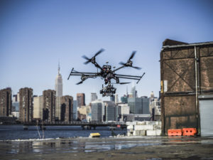
 At Xizmo Media, we often see the phrase “drone surveys near me” come up in search traffic. While many people associate drone services with aerial photography or flashy visuals, the real value of drone surveys goes deeper—especially across key industries. From real estate to energy, drone surveys offer fast, accurate data that helps teams make better decisions. If you’re wondering who actually uses these services and why, we will break it down for you.
Real Estate Developers
Drone surveys help developers get a complete picture of a site before work begins. High-resolution aerial imagery gives context about a lot’s shape, slope, access points, and surrounding features. Developers can assess whether a location is a good fit for their goals without stepping foot on the property.
More importantly, the aerial perspective supports planning and zoning decisions. It becomes easier to visualize where to place roads, utilities, and building footprints. With consistent flyovers, developers can also document each phase of construction from above—useful for stakeholders and marketing purposes.
Construction Firms
In construction, keeping up with site progress is a constant challenge. Drone surveys help teams stay updated by offering frequent, detailed visuals. Whether the job is commercial or residential, drone data supports safety checks, logistics planning, and timeline tracking.
Some firms use drone data to generate 3D models of the project area. This makes it easier to identify potential layout issues, compare site activity over time, and even calculate volumes of material moved on-site. Compared to manual walk-throughs or satellite images, drone surveys offer speed and clarity.
Municipal Planners
Cities and counties also benefit from drone surveys. Planners need accurate information to manage streets, parks, bridges, and public buildings. A drone survey can show surface conditions, measure distances, and offer a full view of public infrastructure without shutting down streets or dispatching multiple teams.
These surveys also support project documentation—both before construction and after work is completed. Planners can present progress reports to city officials or residents using up-to-date visuals. And in dense urban areas like New York City, our team is experienced with navigating permits and working safely around buildings and roads.
Agricultural Operators
Farms and vineyards have started to use drones for more than just visuals. Drone surveys can help identify changes in crop health, spot drainage problems, and assess irrigation coverage. These insights help operators make more efficient use of water, fertilizer, and labor.
For large properties, it’s not practical to walk every acre. Drones cover ground quickly, and with the right sensors, they deliver actionable data. This helps reduce waste and increase yield. Whether it’s monitoring a field from above or measuring plant density, our surveys give agricultural clients the tools they need to manage their land.
Telecom and Energy Companies
Infrastructure inspections take time and often involve hard-to-reach areas. Drone surveys give telecom and energy companies a way to review assets quickly and safely. Towers, solar farms, wind turbines, and power lines can all be reviewed without climbing or driving to remote locations.
These companies often need line-of-sight studies to plan network expansions or installations. A drone can fly the intended path and return detailed imagery or 3D mapping data. This helps engineers avoid surprises and cut down on installation delays.
Thermal sensors and zoom lenses can also be added to detect faults or heat irregularities, offering another layer of insight during a survey. Xizmo Media works closely with utility clients to make this process efficient and reliable.
Event Planners
 Planning an outdoor event comes with a unique set of challenges. Drone surveys give event planners the information they need to design layouts, monitor site access, and plan for safety.
Whether you’re setting up a concert, festival, or large gathering, having a full view of the terrain helps with logistics. You can see where tents, stages, vendors, and bathrooms will fit best. You’ll also get a better idea of crowd flow and emergency access points. After the event, footage can be used for marketing or documentation.
What Xizmo Media Offers
At Xizmo Media, we’ve worked with clients across all of these sectors. Our drone pilots are FAA-certified and experienced in both urban and rural environments. We know how to gather the right data and present it in ways that support decision-making.
We also handle all the technical details. From planning flight paths to securing permits in high-traffic areas, our team manages each part of the process. Whether you need regular flyovers, one-time scans, or post-processed 3D models, we can tailor our work to your needs.
We offer professional drone services across the U.S. and internationally, not just in New York. If you’re searching for “drone surveys near me,” we likely have a team that can support your region and your project goals.
Reach Out Online Today
The demand for drone surveys comes from more than just one industry. Real estate developers, construction firms, city planners, farmers, utility companies, and event coordinators all use drones for different reasons. The common thread is the need for fast, accurate, and safe data collection.
At Xizmo Media, we help clients solve real-world challenges with smart drone solutions. If you’re looking for a drone survey partner with experience across multiple sectors, we’re ready to support your next project.