
What a Professional Real Estate Drone Photographer Brings to Every Listing
 In competitive real estate markets like New York City, visuals can make or break a listing. Buyers now expect more than simple snapshots or ground-level tours. They want to see properties from every angle, including the surrounding neighborhood and amenities.
That is why many agents and developers search for a professional real estate drone photographer instead of relying on traditional photos or DIY drone shots. At Xizmo Media, we see firsthand how professional aerial photography elevates listings and helps properties sell faster.
What Sets a Professional Apart
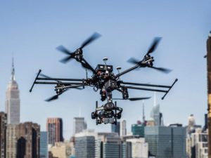
Not all drone photography is created equal. A professional brings skills, licensing, and equipment that hobbyists simply cannot match. FAA certification is one of the most important factors. Licensed operators know how to comply with local and federal airspace rules, which is especially critical in cities with strict regulations like New York.
Framing and lighting also require expertise. A professional real estate drone photographer understands how altitude, time of day, and camera settings affect the look of a property. Instead of random overhead shots, you get carefully composed images that highlight key selling points. Professional drones also carry high-resolution cameras with stabilized flight systems, producing sharp, polished visuals that meet the standards of modern real estate marketing.
How Aerials Transform Residential Listings
For residential properties, aerial photography adds depth that ground-level images cannot provide. Aerials show how a home sits on its lot, the size of the backyard, and the condition of the roof. They also highlight features like pools, gardens, patios, and nearby green spaces. This context helps buyers understand not just the house, but the lifestyle that comes with it.
Neighborhood-level detail is another advantage. Remote buyers, including international clients, often depend on aerial photos to evaluate a property’s location. Seeing nearby parks, schools, or public transit access gives them confidence before they schedule a viewing. For agents, offering this level of detail makes their listings stand out and appear more trustworthy.
Commercial Real Estate Benefits
Commercial listings also gain significant value from professional drone photography. Large properties like office complexes, retail centers, and warehouses can be difficult to capture from the ground. Aerial images give investors a clear view of building scale, parking capacity, and access points. They also highlight surrounding infrastructure, including highways, public transport, and foot traffic patterns.
For developers, aerial photos help market entire projects by showing both the building and its environment. Investors appreciate this perspective because it saves time and provides clarity before they commit to site visits. In markets where competition for funding is high, polished aerial visuals can set a project apart.
Beyond Photography: Video and Mapping Services
 A real estate drone photographer today does more than still images. Video fly-throughs have become a popular way to showcase luxury homes and commercial spaces. Smooth aerial footage combined with interior shots creates a virtual tour that feels dynamic and immersive.
For new developments, 3D mapping and modeling are valuable tools. Drones can capture accurate site data that supports planning and design. Renovation projects also benefit from drone mapping, which gives owners and contractors a full view of existing conditions before work begins. At Xizmo Media, we provide these services alongside traditional photography to give clients flexible options for every stage of property marketing and management.
Xizmo Media’s Process and Expertise
Working in New York City requires more than just technical skill. Our team of professional drone photographers has deep experience with local permitting and restricted airspace. We handle the legal and logistical steps needed to fly safely so clients do not have to worry about compliance.
Our process begins with consultation. We learn the goals of each agent, developer, or property manager and design flight plans that capture the most important features. On shoot day, our FAA-certified pilots and camera operators work together to capture high-quality footage. Afterward, we provide editing and post-production support to deliver polished media that is ready for listings, investor presentations, or marketing campaigns.
Collaboration is central to our approach. We work directly with agents and developers to make sure the final deliverables match the property’s marketing strategy. Whether the goal is attracting buyers, securing investors, or updating stakeholders, our team adapts to meet the specific needs of the project.
The Right Partner for Better Listings
In today’s market, professional drone photography is no longer optional. Buyers expect aerial views, and agents who deliver them gain a clear advantage. A professional real estate drone photographer provides more than images—they provide context, polish, and confidence that help listings perform.
At Xizmo Media, we combine technical expertise, creative direction, and local knowledge to deliver consistent results. Our team helps residential and commercial properties stand out with aerial visuals that capture attention and build trust. If you want your listings to rise above the competition, we invite you to contact us online today. With the right partner, your next property showcase can make a lasting impact.