
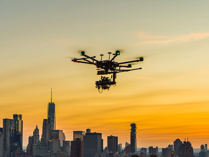
Real Estate Drone Videography; New York
Aerial surveying, inspection from above, cartography, data analysis, and analytics aren’t the only uses for drone mapping services. Services provided by modern drones can be used for a lot more than merely surveying. Aerial mapping services provided by drones can be used for a variety of purposes, including but not limited to: land development, mining, land inspections, construction projects, highways & infrastructures, and real estate.
All throughout the world, including the United States, Europe, and Asia, real estate professionals are employing drone services to survey land, check buildings, and market multi-unit residential developments. They do this so that the land or property is as desirable as possible, knowing that a nice aerial picture will help them make a sale. Professional commercial photographers are employed for the purpose of producing such visually appealing imagery.
In 2015, an agent in Arizona began using a drone to take pictures of properties. Drones are now often used in the real estate industry, at least in the United States. Out of a total of 1,000 commercial drones, over 350 were allotted to use in advertising residential properties. As the photography business continues to embrace the idea of drone photography, there is no sign of slowing down for real estate drone services.
Aerial Drone Services For Real Estate
Highly Engaging and Precise Graphics
Drone photography can be difficult to conceptualize, but aerial drone services streamline the process. You can capture exciting shots with a drone even if you have no experience with them. The quick maneuvering can be attributed to the services’ drones, which enable airborne monitoring and photography. Drones with sufficient power allow for the capture of a large number of high-quality photographs from a variety of angles, greatly improving the quality of any inspection or survey. Stunning graphics are produced from the acquired visual data by sophisticated sensors and processing platforms.
Boosts the Possibility of Listing
We have already established that the primary motivation for using drones for photography is to increase the overall aesthetic appeal of the finished product. This is done so that the property can be listed more effectively. Drone footage shot from above can reveal fascinating details about the homes and streets below. This is a common tactic employed by real estate agents in order to gain new business. Successful estate marketing is the key to turning a profit.
Promotes the Birth of New Businesses
There is no doubt that hiring a drone mapping company can help your business expand into new avenues of success. Real estate and property management, for instance, can benefit from the use of drones to perform virtual tours, opening up new revenue streams. Taking advantage of these virtual tours can be interesting because it gives customers a glimpse of the building as it now exists. Customers can get a sense of the area around the ads thanks to aerial photography and detailed maps.
You’ll avoid wasting time, money, and energy
Taking pictures of a property with a drone is a cost- and time-effective option. If the property is located in a remote area, there is no rush to transport the client there right immediately. Use drones to give them a bird’s-eye view of the entire property without making them get out of their chair. Nowadays drones are equipped with high-definition cameras and better operating quality, allowing them to capture and transmit clear, detailed photographs. Hiring a drone business to handle real estate work is a much more cost-effective option than purchasing a drone.
Shows Precise Results
Scaling and measuring depending on the human judgment has its limitations. Scale and representations obtained from drone monitoring are reliable. Drones have the capability to properly and precisely calculate directions, magnitudes, angles, etc. It is for this reason that aerial surveys, maps, and photographs taken by drones are favored.
Drones are widely used in the marketing of real estate developments in North America. One study found that commercial drones are used in 44% of real estate advertising for aerial mapping. Reports from the National Association of Realtors (NAR) show that drones are becoming increasingly popular for use in the real estate industry. Only 14% of members actually use drones for advertising, but 12% say they know of an office employing them and 18% say they intend to start doing so in the near future.
You should expect success for the idea of using drone services in real estate marketing in the near future thanks to the data presented above by the NAR. Therefore, choose Xizmo Media when searching for an organization to provide aerial mapping services.
For what reason did you choose Xizmo Media? Because our fleet includes some of the most advanced drones available. All the drones we provide are top-of-the-line models capable of taking photos with a high resolution and offering top-notch processing.